


DJI Zenmuse L2 – Care 2 Years
-
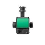
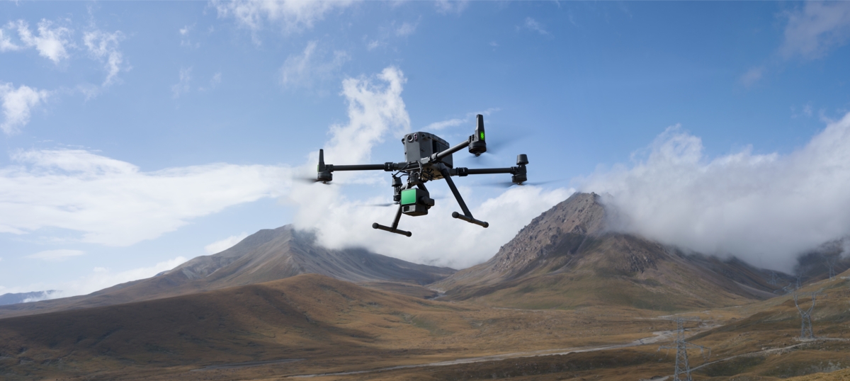
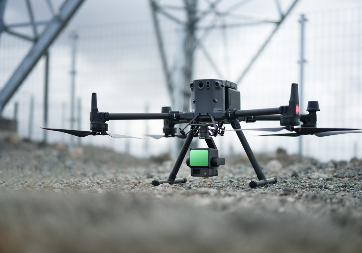
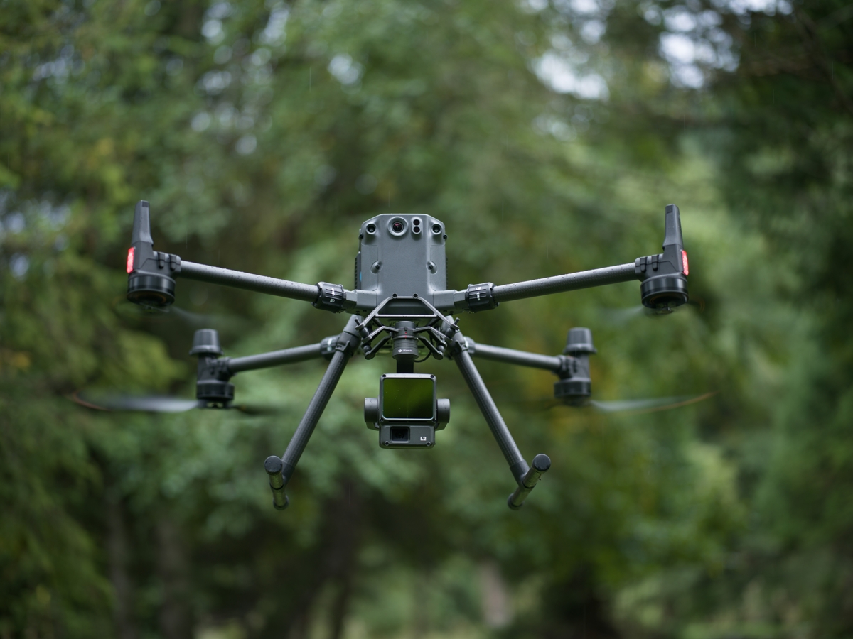
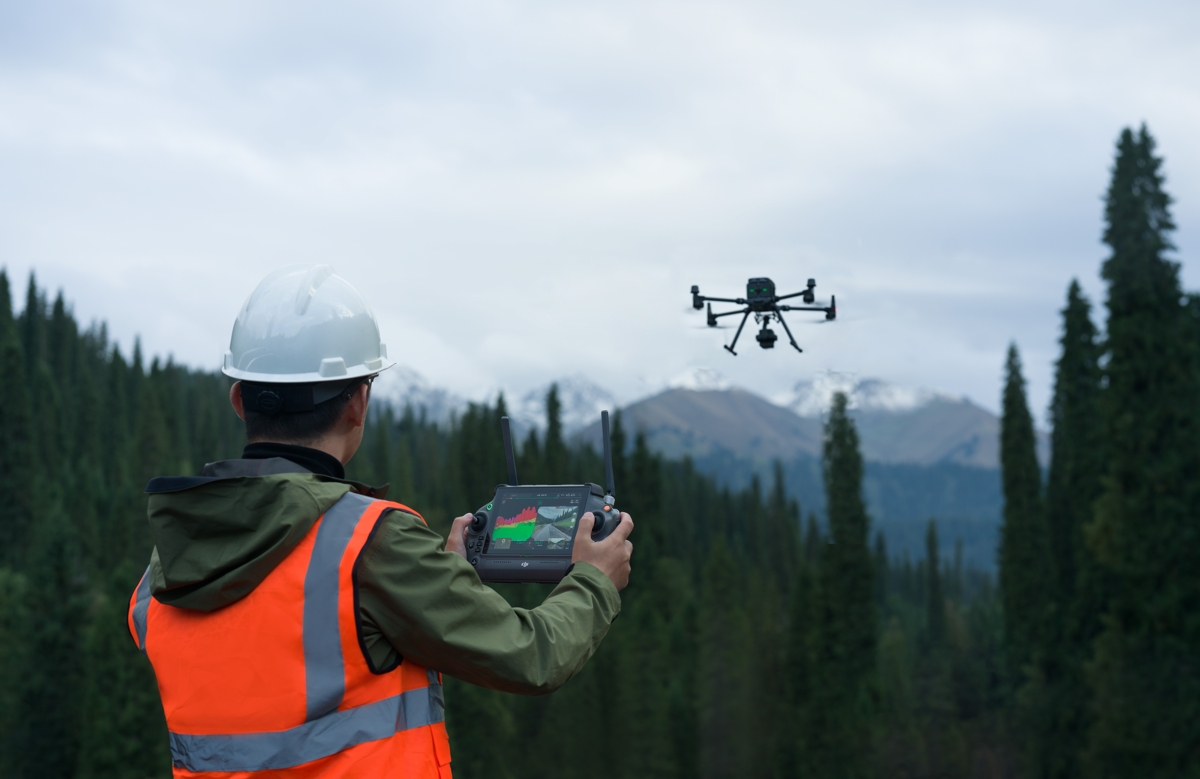
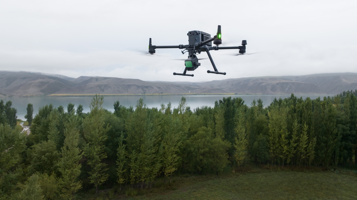
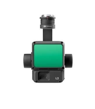
- Zenmuse L2 integrates LiDAR frames, an in-house developed high-precision IMU system and a 4/3 RGB CMOS mapping camera, providing DJI flight platforms with more accurate, efficient and reliable geospatial data acquisition. When used with DJI Terra, it offers a turnkey solution for 3D data collection and high-precision post-processing.
- Public version, at least V3.9 will be able to process L2 data.
- When customers activate L2, using their DJI account, they can use this activated DJI account to access Terra and thus will be able to process L2 point cloud data permanently for free.
- Meanwhile, after activating the L2 account, there will be 3 months of full functionality Terra, will not need to bind additional code, could perform RGB building functionality.
- After 3 months, the RGB functionality will expire, but L2 point cloud data processing will work forever, such as DEM and cross section.
- The customer can also bind the Terra license for the activated L2 account for RGB and L1 point cloud functionality.
- Zenmuse L2 integrates LiDAR frames, an in-house developed high-precision IMU system and a 4/3 RGB CMOS mapping camera, providing DJI flight platforms with more accurate, efficient and reliable geospatial data acquisition. When used with DJI Terra, it offers a turnkey solution for 3D data collection and high-precision post-processing.
- Tempi di spedizioni stimati: Tra i 2 giorni ai 7 giorni lavorativi a seconda del prodotto
- Spese di spedizioni Gratuite: Su tutti gli ordini maggiori di € 3.000
Integrated LiDAR solution
Supported by its powerful hardware, L2 can enable accurate scanning of complex subjects within an extended range and faster point cloud acquisition. During operations, users can preview, playback and process point cloud models on the spot, with activity quality reports generated by DJI Terra, offering a simple and comprehensive solution to improve overall efficiency. This enables users to obtain high-precision point cloud results with unique post-processing.
High-level precision
By combining GNSS and an in-house developed high-precision IMU, this solution achieves a vertical accuracy of 4 cm and a horizontal accuracy of 5 cm. 1
Outstanding efficiency
It is ready to operate as soon as it is turned on and can collect both geospatial and RGB data from an area of 2.5 square kilometers in a single flight. 2
Intuitive operation
In combination with Matrix 350 RTK and DJI Terra, L2 offers an easy-to-use turnkey solution by lowering the operational threshold.
Frame-based LiDAR
Increased detection range by 30% 5
L2 can detect from 250 meters with 10% reflectivity and 100 klx, 3 and up to 450 meters with 50% reflectivity and 0 klx. 3 Typical operating altitude now extends to 120 meters, greatly improving safety and operational efficiency.
Smaller laser dots, denser point clouds
With a reduced spot size of 4×12 cm at 100 m, only one-fifth that of L1, L2 not only detects smaller objects with more detail, but can also penetrate denser vegetation, generating more accurate digital elevation models (DEMs).
Supports 5 returns
In densely vegetated areas, L2 can capture more ground points under the foliage.
Effective point cloud speed: 240,000 points/s
In both single and multiple return modes, L2 can achieve a maximum point cloud emission rate of 240,000 points per second, enabling the acquisition of multiple point cloud data in a given time interval.
Two scanning modes
L2 supports two scanning modes, offering flexibility to users according to their task requirements. In the repetitive scanning mode, L2’s LiDAR can achieve more uniform and accurate point clouds while meeting high-precision mapping requirements. In the non-repetitive scanning mode, it offers deeper penetration for more structural information, making it suitable for power line inspection, forest survey and other scenarios.
Frame-based design
The frame-based design ensures effective point cloud data rates of up to 100%. Combined with a three-axis gimbal, it offers greater scenery detection capabilities.
High-precision IMU system
Improved accuracy
The self-developed high-precision IMU system, combined with the drone’s RTK positioning system for data fusion during post-processing, provides L2 with access to highly accurate absolute position, velocity, and attitude information. In addition, the enhanced environmental adaptability of the IMU system improves L2’s operational reliability and accuracy.
Yaw accuracy 6
Real time: 0.2°, post-processing: 0.05°
Pitch/roll accuracy 6
Real-time 0.05°, post-processing 0.025°
No IMU heating
The performance of the IMU system has been greatly improved, and it is ready for use the moment it is turned on. In addition, the companion drone is ready to start activities immediately once the RTK is in FIX state, providing an optimized field experience.
RGB mapping camera
4/3 CMOS, mechanical shutter
The pixel size has been expanded to 3.3 μm, and the effective pixels now reach 20 MP, resulting in a significant improvement in the overall image and more enriched true-color point cloud details. The minimum interval between photos has been reduced to 0.7 seconds. The mapping camera can count up to 200,000 shutters, further reducing operating costs. When point cloud collection is not necessary, the RGB camera can still take photos and record video or collect images for visible light mapping.
Enhanced operational experience
Diversified flight
Path types
Supports waypoint, area, and linear path types to handle surveying tasks in a variety of environments.
Cloud of dots
Live
During operation, DJI Pilot 2 supports three display modes: RGB, point cloud and side-by-side point cloud/RGB display, presenting operational results in an intuitive way. Activating the RNG (laser rangefinder) provides access to distance information between the LiDAR module and the object in the center of the FOV, improving flight safety. It also supports four real-time point cloud coloring modes: Reflectivity, Height, Distance and RGB.
Point cloud model
Reproduction and fusion
After the operation, the 3D model of point cloud 7 can be viewed directly in the album. It is also possible to merge 3D point cloud models from multiple flights, enabling on-site decision making regarding operational quality.
Automatically generated activity
Quality report
After point cloud data is collected, the DJI Pilot 2 app will automatically generate an activity quality report 8 so that operators can check operational results in real time and on the spot, making field work more responsive and worry-free.
PPK
Solution
Supports waypoint, area, and linear path types to handle surveying tasks in a variety of environments.
One-click processing
about DJI Terra
Get efficient and reliable one-stop post-processing when importing point cloud data into DJI Terra. Generates a 3D point cloud model in standard format with one click after point cloud trajectory calculation and accuracy optimization. After land point classification, using the land point type, a DEM can be generated. The quality of the point cloud can be analyzed with the Check and Verify Accuracy function.
Application scenarios
In coordination with DJI Enterprise and DJI Terra flight platforms, Zenmuse L2 can be applied to land surveying and mapping, electricity, forestry and infrastructure management, and other scenarios.
Notes
1. Measured under the following conditions in a DJI laboratory environment: Zenmuse L2 mounted on a 350 RTK Matrix and turned on. Using the DJI Pilot 2 area route to plan the route of the flight (with Calibra IMU enabled). Using repetitive scanning with RTK in FIX state. The relative altitude was set to 150 m, the flight speed to 15 m/s, the gimbal tilt to -90°, and each straight segment of the flight path was less than 1500 m. The field contained objects with obvious angular features and used exposed hard ground control points that conformed to the diffuse reflection model. DJI Terra was used for post-processing with point cloud accuracy optimization enabled. Under the same conditions with Optimize point cloud precision not enabled, the vertical precision is 4 cm and the horizontal precision is 8 cm.
2. Measured with Zenmuse L2 mounted on Matrix 350 RTK with a flight speed of 15 m/s, flight altitude of 150 m, 20% lateral overlap rate, IMU calibration enabled, elevation optimization turned off, and terrain monitoring turned off.
3. The data presented are typical values. Measured using a flat subject with a size larger than the diameter of the laser beam, perpendicular angle of incidence, and atmospheric visibility of 23 km. In low-light environments, laser beams can reach the optimal detection range. If a laser beam hits more than one subject, the total power of the laser transmitter is divided and the achievable range is reduced. The maximum detection range is 500 m.
4. After power-up, the IMU does not require warm-up; however, users must wait until the RTK drone is in the FIX state before it can fly and operate.
5. Calculated by comparing with Zenmuse L1.
6. Measured under the following conditions in a DJI laboratory environment: Zenmuse L2 mounted on a 350 RTK Matrix and turned on. Using the DJI Pilot 2 area route to plan the route of the flight (with Calibra IMU enabled). RTK in the FIX state. The relative altitude was set to 150 m, the flight speed to 15 m/s, the gimbal tilt to -90°, and each straight segment of the flight path was less than 1500 m.
7. 3D models are processed by sparse representation.
8. Supports only the generation of waypoint, area, and linear activity quality reports.
| trovaprezzi | pubblicato |
|---|
Be the first to review “DJI Zenmuse L2 – Care 2 Years”
Related products
-
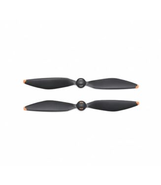
DJI 2110s Propellers M350
Original price was: €48,80.€40,26Current price is: €40,26. Iva inclusa -
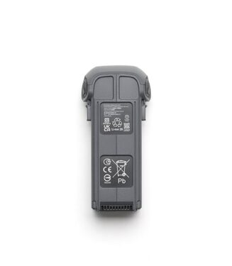
TB65 Intelligent Flight Battery
Original price was: €1.038,22.€851,56Current price is: €851,56. Iva inclusa -
DJI Care Enterprise Basic Y2 (D-RTK 3 Multifunctional Station)
Original price was: €294,02.€241,56Current price is: €241,56. Iva inclusa -
DJI 2112 High Altitude Propellers M350
Original price was: €48,80.€40,26Current price is: €40,26. Iva inclusa


Reviews
There are no reviews yet.